Since my last post, I took a pause from adding areas across the South Island / Te Waipounamu to make some major improvements:
- AI is now used to detect and automate water restriction changes.
- Areas now have a timeline of restriction changes – past, present and upcoming – rather than just current.
- The website has had some upgrades.
AI-powered automation
The platform now uses AI to detect and apply water restriction changes. High confidence changes are applied automatically, while lower confidence changes get manually reviewed.
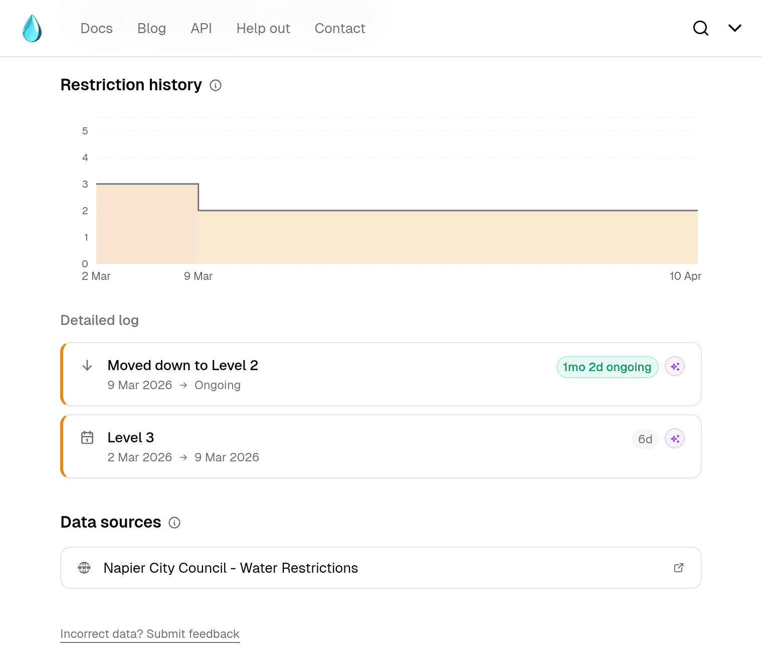
On the website there's now an Auto-detected badge (below) and a sparkle icon to indicate if a change was detected by AI. Both link to how it works for more details.
I still receive notifications for every change and regularly review automatic detections as a sanity check to ensure data is accurate.
This new feature means changes are updated faster, and there is significantly less manual work for me. As coverage grew, the number of change detection notifications I was receiving grew – sometimes 20+ a day – each requiring manual review. This was becoming unsustainable, so the AI automation removes most of that overhead.
Restriction timeline
Previously, only current water restriction levels were supported for each area. Now, each area has a full timeline of changes – past and present restrictions are available, as are upcoming scheduled changes with their end dates when they're known. For example, if an area has a planned move to a higher stage next week, this scheduled change will be visible.
All of this data is also available via the API.
New area pages
Each area now has a dedicated page to see more details about its water restriction information. This includes:
- A visual timeline of how restrictions have changed over time
- Any known upcoming changes
- A more detailed log of individual restriction changes
- The data sources being monitored for that area
Other improvements
A handful of smaller but useful changes are also live:
- Better navigation across the site.
- Blog posts now appear in search results.
- There's now an RSS feed for the blog.
What's next?
Now that the AI process is in place, it's much easier to continue adding support for more areas. Given this, I'll be returning to expanding coverage across the South Island / Te Waipounamu.